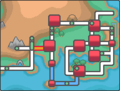
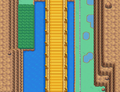
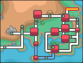
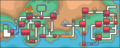
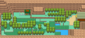
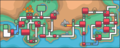
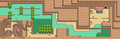
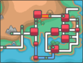
Category:HeartGold and SoulSilver maps
The following are maps from the Generation IV games, Pokémon HeartGold and SoulSilver.
Media in category "HeartGold and SoulSilver maps"
The following 200 files are in this category, out of 534 total.
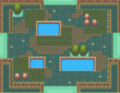
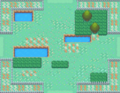
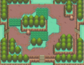
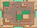
(previous page) (next page) HGSS Whirl Islands-Day.png 256 × 160; 19 KB
 HGSS Whirl Islands-Morning.png 256 × 160; 19 KB
 HGSS Whirl Islands-Night.png 256 × 160; 19 KB
 House of Memories HGSS.png 256 × 192; 13 KB
 House of Memories interior HGSS.png 208 × 227; 12 KB
 Ice Path 1F HGSS.png 896 × 768; 161 KB
 Ice Path B1F HGSS.png 544 × 640; 88 KB
 Ice Path B2F HGSS.png 992 × 384; 89 KB
 Ice Path B3F HGSS.png 512 × 224; 35 KB
 Ilex Forest entrance HGSS.png 256 × 193; 21 KB
 Ilex Forest HGSS.png 836 × 968; 215 KB
 Indigo Plateau Center HGSS.png 336 × 346; 26 KB
 Indigo Plateau HGSS.png 480 × 391; 41 KB
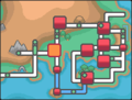
 Johto Azalea Town Map.png 212 × 145; 79 KB
 Johto Bell Tower Map.png 212 × 145; 69 KB
 Johto Blackthorn City Map.png 212 × 145; 79 KB
 Johto Brass Tower Map.png 212 × 145; 69 KB
 Johto Cherrygrove City Map.png 212 × 145; 69 KB
 Johto Cianwood City Map.png 212 × 145; 78 KB
 Johto Dark Cave Map.png 212 × 145; 69 KB
 Johto Dragons Den Map.png 212 × 145; 69 KB
 Johto Ecruteak City Map.png 212 × 145; 79 KB
 Johto Frontier Access Map.png 212 × 145; 78 KB
 Johto Goldenrod City Map.png 212 × 145; 79 KB
 Johto Ilex Forest Map.png 212 × 145; 63 KB
 Johto Lake of Rage Map.png 212 × 145; 69 KB
 Johto Mahogany Town Map.png 212 × 145; 28 KB
 Johto Mt Mortar Map.png 212 × 145; 69 KB
 Johto Mt Silver Map.png 362 × 145; 83 KB
 Johto National Park Map.png 212 × 145; 69 KB
 Johto New Bark Town Map.png 212 × 145; 18 KB
 Johto Olivine City Map.png 212 × 145; 69 KB
 Johto Olivine Lighthouse Map.png 212 × 145; 69 KB
 Johto Route 29 HGSS.png 1,581 × 558; 124 KB
 Johto Route 29 Map.png 212 × 145; 23 KB
 Johto Route 30 HGSS.png 563 × 1,196; 258 KB
 Johto Route 30 Map.png 212 × 145; 69 KB
 Johto Route 31 HGSS.png 1,012 × 472; 131 KB
 Johto Route 31 Map.png 212 × 145; 69 KB
 Johto Route 32 HGSS.png 490 × 2,000; 494 KB
 Johto Route 32 Map.png 212 × 145; 69 KB
 Johto Route 33 HGSS.png 528 × 463; 64 KB
 Johto Route 33 Map.png 212 × 145; 69 KB
 Johto Route 34 HGSS.png 600 × 1,235; 250 KB
 Johto Route 34 Map.png 212 × 145; 69 KB
 Johto Route 35 HGSS.png 560 × 796; 164 KB
 Johto Route 35 Map.png 212 × 145; 69 KB
 Johto Route 36 HGSS.png 1,295 × 470; 143 KB
 Johto Route 36 Map.png 212 × 145; 69 KB
 Johto Route 37 HGSS.png 553 × 454; 68 KB
 Johto Route 37 Map.png 212 × 145; 69 KB
 Johto Route 38 HGSS.png 1,077 × 513; 137 KB
 Johto Route 38 Map.png 212 × 145; 69 KB
 Johto Route 39 HGSS.png 608 × 883; 141 KB
 Johto Route 39 Map.png 212 × 145; 45 KB
 Johto Route 40 HGSS.png 592 × 789; 117 KB
 Johto Route 40 Map.png 212 × 145; 45 KB
 Johto Route 41 HGSS.png 1,040 × 808; 256 KB
 Johto Route 41 Map.png 212 × 145; 45 KB
 Johto Route 42 HGSS.png 1,534 × 395; 158 KB
 Johto Route 42 Map.png 212 × 145; 67 KB
 Johto Route 43 HGSS.png 608 × 834; 217 KB
 Johto Route 43 Map.png 212 × 145; 62 KB
 Johto Route 44 HGSS.png 1,550 × 490; 198 KB
 Johto Route 44 Map.png 212 × 145; 62 KB
 Johto Route 45 HGSS.png 511 × 1,976; 469 KB
 Johto Route 45 Map.png 212 × 145; 62 KB
 Johto Route 46 HGSS.png 601 × 797; 154 KB
 Johto Route 46 Map.png 212 × 145; 62 KB
 Johto Route 47 HGSS.png 1,441 × 953; 347 KB
 Johto Route 47 Map.png 212 × 145; 60 KB
 Johto Route 48 HGSS.png 767 × 542; 93 KB
 Johto Route 48 Map.png 212 × 145; 59 KB
 Johto Ruins of Alph Map.png 212 × 145; 65 KB
 Johto Safari Zone Desert HGSS.png 496 × 384; 56 KB
 Johto Safari Zone Forest HGSS.png 496 × 384; 66 KB
 Johto Safari Zone HGSS.png 208 × 192; 9 KB
 Johto Safari Zone Map.png 212 × 145; 78 KB
 Johto Safari Zone Marshland HGSS.png 496 × 384; 63 KB
 Johto Safari Zone Meadow HGSS.png 496 × 384; 59 KB
 Johto Safari Zone Mountain HGSS.png 496 × 384; 86 KB
 Johto Safari Zone Peak HGSS.png 496 × 384; 68 KB
 Johto Safari Zone Plains HGSS.png 496 × 384; 45 KB
 Johto Safari Zone Rocky Beach HGSS.png 496 × 384; 70 KB
 Johto Safari Zone Savannah HGSS.png 496 × 384; 50 KB
 Johto Safari Zone Swamp HGSS.png 496 × 384; 66 KB
 Johto Safari Zone Wasteland HGSS.png 496 × 384; 71 KB
 Johto Safari Zone Wetland HGSS.png 496 × 384; 60 KB
 Johto Sinjoh Ruins Map.png 194 × 145; 20 KB
 Johto Slowpoke Well Map.png 212 × 145; 55 KB
 Johto Sprout Tower Map.png 212 × 145; 69 KB
 Johto SS Aqua Map.png 362 × 145; 14 KB
 Johto Union Cave Map.png 212 × 145; 69 KB
 Johto Violet City Map.png 212 × 145; 69 KB
 Johto Whirl Islands Map.png 212 × 145; 69 KB
 Johto-Kanto.png 362 × 145; 13 KB
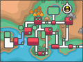
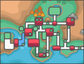 Johto.png 192 × 145; 38 KB
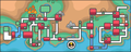
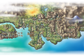 JohtoMap.png 1,280 × 859; 1.63 MB
 Kanto Celadon City Map.png 192 × 145; 19 KB
 Kanto Cerulean Cave Map.png 192 × 145; 18 KB
 Kanto Cerulean City Map.png 192 × 145; 19 KB
 Kanto Cinnabar Island Map.png 192 × 145; 18 KB
 Kanto Digletts Cave Map.png 192 × 145; 18 KB
 Kanto Fuchsia City Map.png 192 × 145; 19 KB
 Kanto Gym HGSS.png 116 × 89; 3 KB
 Kanto Indigo Plateau Map.png 192 × 145; 19 KB
 Kanto Johto Miracle Cycle Map.png 362 × 145; 91 KB
 Kanto Lavender Town Map.png 192 × 145; 19 KB
 Kanto Mt Moon Map.png 192 × 145; 19 KB
 Kanto Pal Park Map.png 192 × 145; 19 KB
 Kanto Pallet Town Map.png 192 × 145; 19 KB
 Kanto Pewter City Map.png 192 × 145; 19 KB
 Kanto Power Plant Map.png 192 × 145; 19 KB
 Kanto Rock Tunnel Map.png 192 × 145; 19 KB
 Kanto Route 1 HGSS.png 462 × 880; 88 KB
 Kanto Route 1 Map.png 192 × 145; 5 KB
 Kanto Route 10 HGSS.png 512 × 1,044; 99 KB
 Kanto Route 10 Map.png 192 × 145; 19 KB
 Kanto Route 11 HGSS.png 1,024 × 512; 82 KB
 Kanto Route 11 Map.png 192 × 145; 19 KB
 Kanto Route 12 HGSS.png 512 × 1,546; 187 KB
 Kanto Route 12 Map.png 192 × 145; 19 KB
 Kanto Route 13 HGSS.png 1,536 × 512; 91 KB
 Kanto Route 13 Map.png 192 × 145; 19 KB
 Kanto Route 14 HGSS.png 512 × 1,024; 105 KB
 Kanto Route 14 Map.png 192 × 145; 19 KB
 Kanto Route 15 HGSS.png 1,536 × 512; 74 KB
 Kanto Route 15 Map.png 192 × 145; 19 KB
 Kanto Route 16 HGSS.png 1,024 × 492; 93 KB
 Kanto Route 16 Map.png 192 × 145; 19 KB
 Kanto Route 17 HGSS.png 512 × 2,048; 225 KB
 Kanto Route 17 Map.png 192 × 145; 19 KB
 Kanto Route 18 HGSS.png 1,039 × 442; 76 KB
 Kanto Route 18 Map.png 192 × 145; 19 KB
 Kanto Route 19 HGSS.png 512 × 1,024; 104 KB
 Kanto Route 19 Map.png 192 × 145; 19 KB
 Kanto Route 2 HGSS.png 512 × 1,536; 129 KB
 Kanto Route 2 Map.png 192 × 145; 18 KB
 Kanto Route 20 HGSS.png 2,048 × 512; 146 KB
 Kanto Route 20 Map.png 192 × 145; 19 KB
 Kanto Route 21 HGSS.png 512 × 1,536; 138 KB
 Kanto Route 21 Map.png 192 × 145; 19 KB
 Kanto Route 22 HGSS.png 1,024 × 492; 95 KB
 Kanto Route 22 Map.png 192 × 145; 19 KB
 Kanto Route 24 HGSS.png 513 × 392; 62 KB
 Kanto Route 24 Map.png 192 × 145; 5 KB
 Kanto Route 25 HGSS.png 2,123 × 398; 162 KB
 Kanto Route 25 Map.png 192 × 145; 5 KB
 Kanto Route 26 HGSS.png 512 × 2,118; 269 KB
 Kanto Route 26 Map.png 192 × 145; 19 KB
 Kanto Route 27 HGSS.png 3,152 × 480; 363 KB
 Kanto Route 27 Map.png 362 × 145; 83 KB
 Kanto Route 28 HGSS.png 992 × 448; 119 KB
 Kanto Route 28 Map.png 362 × 145; 83 KB
 Kanto Route 3 HGSS.png 1,536 × 502; 131 KB
 Kanto Route 3 Map.png 192 × 145; 18 KB
 Kanto Route 4 HGSS.png 1,600 × 512; 123 KB
 Kanto Route 4 Map.png 192 × 145; 19 KB
 Kanto Route 5 HGSS.png 512 × 522; 55 KB
 Kanto Route 5 Map.png 192 × 145; 18 KB
 Kanto Route 6 HGSS.png 480 × 538; 40 KB
 Kanto Route 6 Map.png 192 × 145; 19 KB
 Kanto Route 7 HGSS.png 512 × 502; 48 KB
 Kanto Route 7 Map.png 192 × 145; 19 KB
 Kanto Route 8 HGSS.png 1,127 × 301; 81 KB
 Kanto Route 8 Map.png 192 × 145; 19 KB
 Kanto Route 9 HGSS.png 1,536 × 502; 134 KB
 Kanto Route 9 Map.png 192 × 145; 19 KB
 Kanto Saffron City Map.png 192 × 145; 19 KB
 Kanto Seafoam Islands Map.png 192 × 145; 19 KB
 Kanto Tohjo Falls Map.png 362 × 145; 83 KB
 Kanto Underground Path 5-6 Map.png 192 × 145; 18 KB
 Kanto Vermilion City Map.png 192 × 145; 19 KB
 Kanto Victory Road Map.png 362 × 145; 83 KB
 Kanto Viridian City Map.png 192 × 145; 19 KB
 Kanto Viridian Forest Map.png 192 × 145; 19 KB
 Kanto.png 192 × 145; 8 KB
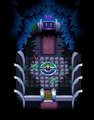
 Karen Room HGSS.png 298 × 354; 26 KB
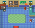
 Koga Room HGSS.png 321 × 410; 48 KB
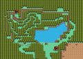 Lake of Rage HGSS dry.png 1,309 × 929; 226 KB
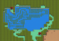 Lake of Rage HGSS wet.png 1,309 × 929; 216 KB
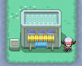
 Lavender Radio Tower 1F HGSS.png 320 × 163; 11 KB
 Lavender Radio Tower HGSS.png 110 × 233; 4 KB
 Lavender Town HGSS.png 443 × 506; 59 KB
 Mahogany Gym Exterior HGSS screenshot.png 256 × 192; 38 KB
 Mahogany Gym HGSS.png 208 × 768; 28 KB
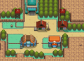 Mahogany Town HGSS.png 567 × 412; 67 KB
 Mahogany Town Shop HGSS.png 176 × 144; 10 KB
 Miracle Cycle Cerulean exterior HGSS.png 148 × 120; 6 KB
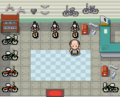
 Miracle Cycle Cerulean interior HGSS.png 192 × 155; 7 KB
 Miracle Cycle Goldenrod exterior HGSS.png 150 × 120; 8 KB
 Miracle Cycle Goldenrod interior HGSS.png 192 × 155; 8 KB
 MooMoo Farm Barn HGSS.png 320 × 144; 10 KB
 MooMoo Farm HGSS.png 275 × 501; 42 KB
 MooMoo Farm House HGSS.png 208 × 144; 7 KB
 Mr Psychic House HGSS.png 170 × 115; 6 KB
 Mt Moon 1F HGSS.png 733 × 347; 61 KB
 Mt Moon Square HGSS.png 822 × 403; 74 KB
 Mt Mortar Basement HGSS.png 960 × 948; 187 KB
 Mt Mortar Entrance HGSS.png 1,424 × 820; 201 KB


