File:Galar Hammerlocke Hills dens SwSh.png
Size of this preview: 800 × 370 pixels. Other resolution: 848 × 392 pixels.
Full-size image (848 × 392 pixels, file size: 522 KB, MIME type: image/png)
Summary
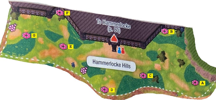
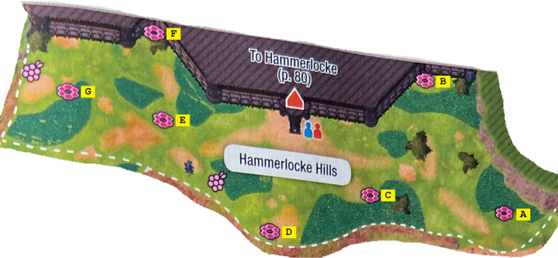
A map of Hammerlocke Hills with its Pokémon Dens marked.
Licensing
| This image is a scan from a Pokémon game booklet or guide, or substantially derived from one. The contributor claims this to be fair use. | 
|
File history
Click on a date/time to view the file as it appeared at that time.
| Date/Time | Thumbnail | Dimensions | User | Comment | |
|---|---|---|---|---|---|
| current | 16:28, 4 April 2020 | | 848 × 392 (522 KB) | Tiddlywinks (talk | contribs) | A map of {{bp|Hammerlocke Hills}} with its {{bp|Pokémon Den}}s marked. Category:Game maps Category:Galar maps |
You cannot overwrite this file.
File usage
There are no pages that use this file.
Global file usage
The following other wikis use this file:
- Usage on bulbapedia.bulbagarden.net